Best Truck GPS Systems That Big-Rig Drivers Trust
You trust your big rig to carry your livelihood down long stretches of highway, and the Garmin dezl OTR710 delivers with a 7-inch 1024×600 touchscreen and precise truck-specific routing. It avoids low bridges and restricted roads using height, weight, and hazardous cargo inputs. Preloaded North American maps include lifetime updates. Real-time PrePass alerts, Bluetooth connectivity, and dēzl app integration enhance efficiency. Advanced wind overlays and satellite imagery give you an edge-discover which model aligns best with your hauling demands.
We are supported by our audience. When you purchase through links on our site, we may earn an affiliate commission, at no extra cost for you. Learn more. Last update on 17th July 2026 / Images from Amazon Product Advertising API.
Notable Insights
- High-resolution touchscreens with sunlight readability provide clear visibility for long-haul truckers in all conditions.
- Preloaded North American maps with lifetime updates ensure accurate, up-to-date routing without subscription fees.
- Custom truck routing by height, weight, length, and cargo type avoids restricted roads and low-clearance obstacles.
- Real-time alerts for sharp curves, weigh stations, speed limits, and red-light cameras enhance driver safety and compliance.
- Bluetooth and Wi-Fi connectivity enable live traffic, weather updates, and fleet integration for smarter route planning.
Garmin dezl OTR710 7″ GPS Truck Navigator (Renewed)

If you’re a professional truck driver who needs reliable, route-optimized navigation tailored to large vehicles, the Garmin dezl OTR710 7″ GPS Truck Navigator (Renewed) is built for your needs. Its 7-inch high-resolution touchscreen delivers clear, responsive control. Bluetooth connectivity links to smartphones, the dēzl app, and accessories like the BC 50 camera or dēzl smartwatch. Custom routing accounts for your vehicle’s height, weight, and cargo type, avoiding low bridges and restricted roads. It alerts you to sharp curves, steep grades, and weigh stations, with PrePass support for bypasses. Preloaded North American maps include the U.S., Canada, Mexico, and Caribbean territories. BirdsEye Satellite Imagery lets you scout loading zones visually. Route planning finds fuel stops, rest areas, and truck-friendly parking, filtering by brand or amenity-like showers at Love’s. Real-time traffic, weather, and smart notifications sync via Bluetooth. The system displays loyalty points from Pilot and Love’s networks. Integrations enhance efficiency without distracting from the road. This device is engineered for precision, safety, and daily productivity in long-haul operations.
Best For: Professional truck drivers who need a reliable, large-vehicle-optimized GPS with advanced routing, safety alerts, and integrated trucking services for long-haul operations.
Pros:
- 7-inch high-resolution touchscreen with responsive touch control and Bluetooth connectivity for seamless integration with smartphones and accessories
- Custom truck-specific routing with alerts for bridge heights, weight limits, sharp curves, steep grades, and PrePass weigh station bypass support
- Preloaded North American maps with BirdsEye Satellite Imagery, detailed trucking services directory, and real-time traffic, weather, and loyalty point visibility
Cons:
- Requires active smartphone connection via Bluetooth for live traffic, weather, and smart notifications, limiting standalone functionality
- Renewed unit may have minor cosmetic imperfections or varied battery life compared to new devices
- Advanced features like satellite imagery and app integration depend on subscription or compatible smartphone models
Garmin dezl OTR610 6″ GPS Truck Navigator

The Garmin dezl OTR610 6” GPS Truck Navigator is built for professional long-haul drivers who need precise, truck-specific routing and real-time connectivity. Its 6-inch touchscreen delivers bright, high-resolution visuals for easy reading in direct sunlight. I rely on its custom routing based on my truck’s height, weight, and hazardous cargo to avoid low bridges and steep grades. BirdsEye Satellite Imagery helps me spot loading docks and secure entrances clearly. The device guides me to fuel stops, rest areas, and truck-friendly parking. Using the dēzl app, I get PrePass alerts and live updates on traffic, weather, and Love’s loyalty points-all via Bluetooth and a smartphone.
Best For: Professional long-haul truck drivers who need reliable, truck-specific routing and real-time connectivity features for safer, more efficient trips.
Pros:
- Custom truck routing based on vehicle dimensions and cargo type helps avoid road hazards like low bridges and steep grades
- BirdsEye Satellite Imagery provides clear aerial views of loading docks and secure entrances for easier maneuvering
- Integrated dēzl app delivers PrePass alerts, live traffic, weather, and loyalty point tracking via smartphone connectivity
Cons:
- Requires a smartphone and active data connection for full functionality of live features and notifications
- PrePass notifications depend on an active PrePass account and compatible Bluetooth setup
- Advanced features like BC 50 camera and dēzl headset require additional purchases for full integration
Truck GPS Navigator 9″ 2026 Maps

Who needs pinpoint accuracy and up-to-date routing for long-haul trucking across North America? I do, and that’s why I rely on the Truck GPS Navigator 9″ 2026 Maps. It comes preloaded with detailed 2026 maps covering the U.S., Canada, and Mexico. I get free lifetime map updates via Windows PC or TF card-just not Mac-compatible. The 9-inch 800×480 touchscreen delivers sharp 2D and 3D views. I customize routes by height, weight, and cargo type. It warns me about bridges, curves, and crossings. I use truck, bus, or ambulance modes. Spoken directions support 40+ languages. FM audio sends turn-by-turn alerts through my speakers. U.S. support guarantees reliability. I charge fully before first use and lock satellites outdoors.
Best For: Long-haul truckers and commercial drivers who need reliable, truck-specific navigation across North America with up-to-date maps and route customization.
Pros:
- Preloaded 2026 North America maps with free lifetime updates via Windows PC or TF card
- Customizable routing based on truck dimensions, weight, and cargo with critical safety alerts
- 9-inch touchscreen with 2D/3D views and FM audio output for clear turn-by-turn directions through vehicle speakers
Cons:
- Not compatible with Mac computers for map updates
- Requires outdoor satellite acquisition and initial full charge for optimal setup
- Limited to FM audio transmission without built-in radio support
OHREX N700 GPS Navigator for Trucks
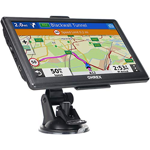
While many GPS units serve general drivers well, the OHREX N700 stands out specifically for professional truckers who need reliable, vehicle-specific routing across North America. I rely on its 7-inch capacitive touchscreen with 800 × 480 resolution for clear visibility. It runs on a Windows-based system with 8 GB ROM and 256 MB RAM, supporting updates via USB or 32 GB TF card. Preloaded 2026 maps cover the U.S., Canada, and Mexico, with free lifetime updates. I program my truck’s height, weight, and length to avoid restricted roads. It gives turn-by-turn directions, lane guidance, and speed camera alerts. The 3000 mAh battery lasts two hours.
Best For: Professional truck drivers who need reliable, vehicle-specific routing across North America with customizable dimension settings and lifetime map updates.
Pros:
- Preloaded 2026 North America maps with free lifetime updates via Windows PC
- Custom truck routing based on height, weight, length, and width to avoid road restrictions
- Built-in FM transmitter and voice-guided navigation with speed camera and lane change alerts
Cons:
- Limited to 2 hours of battery life, restricting use outside the vehicle
- Windows-based system not compatible with Mac computers
- Only 8 GB of internal storage, requiring a TF card for additional map downloads
9″ Truck GPS Navigator with Lifetime Maps
You’re a professional driver who needs reliable, hassle-free navigation tailored to large vehicles-this 9-inch truck GPS navigator with lifetime maps is built for you. It supports custom truck routing based on your vehicle’s height, weight, length, and axle count. That means no more low-bridge strikes or restricted-road violations. Preloaded 2026 maps cover the U.S., Canada, and Mexico, with free lifetime updates-no Wi-Fi, subscriptions, or data needed. The 9-inch HD touchscreen delivers clear, real-time guidance: speed, ETA, lane assist, and camera alerts. You’ll get voice prompts, red light warnings, and speed limit notifications to stay compliant. Everything you need is in the box-device, charger, mount, and cable-ready to use, no phone pairing required.
Best For: Professional truck drivers, RV owners, and operators of large vehicles who need reliable, offline navigation with custom routing based on vehicle specifications.
Pros:
- Custom truck routing tailored to vehicle dimensions (height, weight, length, axle count) to avoid restricted roads and bridges
- Lifetime map updates with preloaded 2026 maps covering the U.S., Canada, and Mexico-no subscription or internet required
- Large 9-inch HD touchscreen with clear turn-by-turn directions, speed warnings, and driver alerts for enhanced safety
Cons:
- Limited to fixed GPS functionality without smartphone integration or app-based features
- Larger screen may be cumbersome for compact dashboards or small cabs
- No real-time traffic updates due to lack of internet connectivity
Garmin dezl 7″ GPS Navigator for Trucks
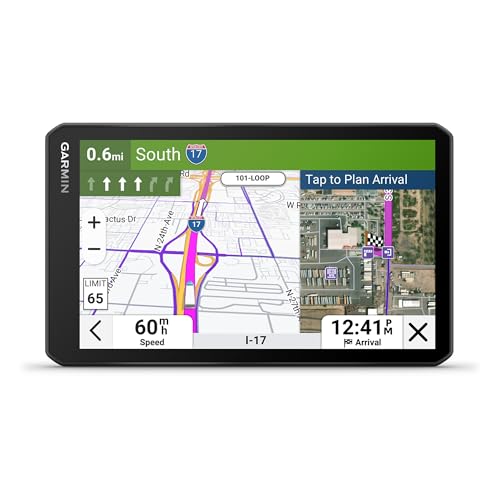
The Garmin dezl 7″ GPS Navigator for Trucks stands out as the best choice for professional over-the-road drivers who need precise, vehicle-specific routing and real-time situational awareness. I rely on its 7-inch touchscreen with 1024 x 600 resolution for clear visibility. It weighs just 8.5 ounces and measures 4.2 x 0.8 x 7 inches. It uses vehicle-specific profiles for height, weight, and cargo type. Real-time PrePass alerts help me skip weigh stations. I access community-rated parking, loading docks, and truck routes via Bluetooth and Wi-Fi. BirdsEye Satellite Imagery shows exact destination layouts. Wind overlays and high-wind alerts improve safety.
Best For: Professional over-the-road truck drivers who require precise, size- and weight-specific routing and real-time safety and location-based alerts.
Pros:
- Offers truck-specific routing with alerts for bridges, curves, and road hazards based on vehicle dimensions and cargo
- Integrates with PrePass and community-shared data for weigh station bypasses, parking availability, and popular truck routes
- Enhances situational awareness with wind speed overlays, BirdsEye Satellite Imagery, and real-time high-wind alerts
Cons:
- Requires a smartphone and dēzl app pairing for full functionality of real-time alerts and parking data
- Limited to Bluetooth and Wi-Fi connectivity without built-in cellular for standalone updates
- PrePass integration needs an active account and compatible smartphone, adding extra cost and setup
7″ GPS Navigator for Car & RV (Blue)
If you’re a driver operating with a large vehicle like an RV or truck, this 7″ GPS navigator is built specifically for your needs. It weighs 1.57 pounds and features a high-sensitivity touchscreen for easy control. Preloaded with 2026 maps of North America, it includes lifetime free updates and supports European and UK downloads. I can input my vehicle’s exact dimensions-height, weight, length, width-to avoid restricted roads. It offers four route modes: fastest, green, short, and easy. Turn-by-turn voice guidance works in English or French. A built-in FM transmitter sends audio to my car speakers. Real-time alerts warn me about speed limits, red lights, and cameras. It’s compatible with cars, trucks, RVs, buses, taxis, and emergency vehicles. The package includes a car charger, USB cable, suction cup mount, sun visor mount, and user manual. It ships with a 12V battery and is ready for plug-and-play use. ASIN: B0G1991GJM. Available since November 7, 2025. Ranked #4 in Vehicle GPS Units & Equipment and #5 in Car In-Dash Navigation GPS Units. Backed by a 1-year warranty. Eligible for Amazon’s 30-day return policy.
Best For: Drivers of large vehicles such as RVs, trucks, and buses who need customized routing based on vehicle dimensions and restrictions.
Pros:
- Preloaded with 2026 North America maps and supports lifetime free updates plus European and UK map downloads
- Allows vehicle-specific routing by inputting weight, height, length, and width to avoid restricted roads
- Offers turn-by-turn voice guidance in multiple languages and real-time alerts for speed limits, red lights, and cameras
Cons:
- Limited to English and French for voice guidance, lacking broader language support
- Heavier at 1.57 pounds compared to standard GPS devices, which may affect portability
- No mention of offline search or real-time traffic updates beyond basic alerts
Truck GPS Navigator with Lifetime Updates

I rely on precision and long-term value when choosing a truck GPS, and this navigator delivers both for professional drivers who demand up-to-date routing without recurring costs. It features a 7-inch display with 2D/3D map views and automatic day/night mode. Turn-by-turn voice guidance supports over 40 languages. It comes preloaded with 2026 maps for the USA, Canada, and Mexico. I get free lifetime updates; EU, UK, Ireland, and Australia maps are available on request. It supports multiple vehicle types, including semi-trucks, with routing based on height, weight, and road restrictions.
Best For: Professional truck drivers and commercial vehicle operators seeking reliable, up-to-date navigation with lifetime map updates and truck-specific routing.
Pros:
- Preloaded 2026 maps for North America with free lifetime updates ensure long-term accuracy and value
- Supports multiple vehicle types with customized truck routing based on height, weight, and road restrictions
- Comprehensive driver alerts for safety hazards like speed changes, curves, and railroad crossings enhance route safety
Cons:
- Satellite signal acquisition requires outdoor use, which may delay startup in enclosed areas
- FM transmitter provides audio output only and does not support FM radio functionality
- International maps for EU, UK, Ireland, and Australia are available only upon request, not preinstalled
Garmin dēzl OTR620 6” GPS Truck Navigator

You get a 6-inch high-resolution touchscreen that delivers crisp, bright visuals essential for long-haul visibility, even in direct sunlight. I rely on BirdsEye Direct Satellite Imagery to scout drop-offs and yard layouts before arrival. My route adapts to my rig’s height, weight, and length, avoiding low bridges and sharp curves. Real-time wind overlays warn of dangerous conditions, pulling data through my paired smartphone. I navigate confidently using crowd-sourced popular truck routes and find trusted parking with live availability. PrePass integration alerts me to open weigh stations, saving time. The dēzl app delivers traffic, parking ratings, and scale locations-all critical for staying on schedule and legal.
Best For: Long-haul truckers who need a reliable, truck-optimized GPS with real-time connected features for efficient, safe, and compliant route planning.
Pros:
- Custom routing based on truck dimensions and weight to avoid road hazards and restricted areas
- Real-time wind speed overlays and PrePass integration for enhanced safety and weigh station bypass efficiency
- Crowd-sourced truck parking availability, ratings, and truck-specific points of interest for better arrival planning
Cons:
- Requires smartphone pairing for full connected features, limiting functionality without a compatible device
- Subscription or app dependency for BirdsEye imagery and live traffic/parking data may add ongoing costs
- Larger 6-inch unit may be less ideal for cabs with limited dashboard space
9″ GPS Navigator for Car, Truck, RV

This GPS navigator is ideal for professional drivers and road enthusiasts who rely on precise routing for large or specialized vehicles. I use a 9-inch touchscreen, offering 30% more screen area than 7-inch models, for clear 2D and 3D map views. I feature preloaded 2026 maps of North America with lifetime updates and support downloadable EU and UK maps. My custom routing adjusts to your vehicle’s height, width, and weight, avoiding restricted roads. I provide active safety alerts for speed limits, school zones, and sharp curves. I include a car charger, USB cable, dashboard mount, and manual-ready to install and use right away.
Best For: Professional drivers and road enthusiasts needing precise routing for large or specialized vehicles like trucks, RVs, and buses.
Pros:
- 9-inch touchscreen offers 30% more screen area than 7-inch models for clearer 2D and 3D map visibility
- Preloaded 2026 North America maps with lifetime free updates, plus downloadable EU and UK maps
- Custom vehicle routing based on height, width, and weight to avoid restricted roads and enhance safety
Cons:
- Larger 9-inch size may be cumbersome for smaller dashboards or compact vehicles
- Reliance on downloadable maps for EU and UK, not preloaded like North America
- No mention of real-time traffic updates or voice command functionality
Factors to Consider When Choosing a Buy Truck GPS
You need a truck GPS that fits your rig and route demands. Look for a display size of at least 5 inches with high resolution (800×480 pixels or better) so you can read it quickly in sunlight. These screens make navigation easier, especially when combined with accurate mapping coverage, turn-by-turn directions for trucks, real-time alerts for traffic or low bridges, and reliable update options via Wi-Fi or Bluetooth.
Display Size And Clarity
Screen real estate matters when traversing long stretches of highway, and display size plays a critical role in readability and driver safety. A 9-inch screen gives you up to 30% more viewing area than a 7-inch model, making map details easier to see at a glance. You’ll want at least 800×480 resolution for sharp, clear images that reduce eye strain over long shifts. High-contrast, bright displays adjust automatically between day and night, maintaining visibility in direct sunlight or dark conditions. Touch response must remain reliable, even on rough roads-capacitive touchscreens offer faster, smoother input than resistive types. Look for wide viewing angles too; they let you read the display clearly from different seat positions without color distortion. These features work together to keep your eyes on the road and hands where they belong.
Mapping Accuracy And Coverage
While traversing complex freight networks, precise mapping becomes non-negotiable for safe and efficient operations. You need truck GPS systems with preloaded, detailed maps covering the U.S., Canada, and Mexico for seamless cross-border navigation. These maps include critical truck-specific data like bridge heights, weight limits, and sharp road curves, preventing costly or dangerous routing errors. Satellite imagery integration lets you preview destinations, confirming exact locations of loading docks and truck-friendly entrances before arrival. To keep your navigation current, choose models with free lifetime map updates, guaranteeing you receive the latest road changes, construction zones, and speed limit adjustments. Offline map capability ensures uninterrupted performance in remote areas with poor or no internet connectivity-crucial for long-haul reliability. Relying on continuously updated, extensive mapping keeps your routes accurate, legal, and efficient across North America’s vast transportation network.
Truck Specific Routing Options
When selecting a truck GPS, one of the most critical features to evaluate is its ability to provide customized routing based on your vehicle’s specific dimensions and cargo. You need a system that adjusts navigation using your truck’s height, weight, length, and width to avoid low bridges, weight-restricted roads, and other hazards. These devices rely on detailed maps with embedded truck-specific restrictions across the U.S., Canada, and Mexico. The routing engine calculates the safest, legal path by applying commercial regulations to your profile. You can set parameters for hazardous materials, oversized loads, or toll avoidance. Some units support multiple vehicle types-like semi-truck, bus, or RV-each with custom rules. Accurate input guarantees precise route calculation. Without this, you risk fines, damage, or delays. It’s not just convenience-it’s compliance.
Real Time Alerts And Warnings
What if your GPS could warn you about a 15% grade or a wind gust strong enough to tip your trailer? Real-time alerts do exactly that, using your truck’s height, weight, and length to flag hazards like low bridges, sharp curves, and steep inclines. Systems detect road grades up to 12% and clearance levels as low as 8 feet, adjusting warnings dynamically. You’ll get immediate notifications for high winds exceeding 35 mph, which can sway your trailer. Active safety features alert you to nearby speed cameras, red-light intersections, and railroad crossings. Live traffic and weather overlays highlight construction zones, sudden storms, or road closures ahead. Some models integrate with fleet services to deliver weigh station bypass alerts when open. These alerts are calculated using real-time meteorological data, GPS positioning, and vehicle profile matching. They enhance situational awareness, letting you react faster and stay compliant.
Connectivity And Update Features
Your truck’s GPS does more than guide you-it connects you to a network of live data that keeps your route optimized and up to date. Bluetooth connectivity pairs with your smartphone, enabling real-time traffic, weather, and smart notifications without requiring a built-in cellular connection. Wi-Fi capability guarantees automatic over-the-air map and software updates, eliminating manual downloads via computer. Some models support live data sharing through community networks, offering crowd-sourced insights on truck parking, road conditions, and popular routes. Preloaded maps with free lifetime updates maintain accuracy over time, delivered through direct downloads or PC sync. Integration with mobile apps via wireless communication activates dynamic features like weigh station bypass alerts and destination search based on your current location. These connectivity tools keep your system current and reliable, reducing downtime and increasing efficiency on every haul.
Durability And Mounting Flexibility
A truck GPS must endure the physical demands of long-haul driving while remaining securely mounted and easy to use. Choose a rugged device built with shock-absorbing materials to handle constant vibration and temperatures from -4°F to 140°F. Look for models with reinforced casings and sealed ports to protect internal components. Use a reliable suction cup or hard dash mount that grips firmly, even on rough terrain. The mount should support quick repositioning and offer adjustable angles for clear visibility without blocking your view. Pick a GPS with a responsive, glove-friendly touchscreen that works in rain or cold-no repeated taps needed. Opt for an anti-glare display with automatic brightness to stay readable in harsh sun or night driving. These features keep your system stable, visible, and functional mile after mile.
Frequently Asked Questions
Can Truck GPS Systems Provide Real-Time Traffic Updates?
Yes, truck GPS systems provide real-time traffic updates using embedded cellular connectivity or paired smartphones. They pull data from cloud-based services like HD Traffic or Google Waze, updating every 30 to 60 seconds. You receive alerts for congestion, accidents, and construction, with rerouting based on current conditions. Advanced models integrate predictive flow algorithms and support over-the-air firmware updates. You’ll see color-coded road overlays and estimated delay times, ensuring route efficiency and fuel savings on long-haul trips.
Are Truck GPS Devices Compatible With All Vehicle Types?
No, truck GPS devices aren’t compatible with all vehicle types. They’re designed for large commercial vehicles, not cars or motorcycles. Using one in a sedan won’t break it, but routing adjusts for height, weight, and hazardous material restrictions. Units like the Garmin dezl 780LMT include 7” touchscreens, support for Bluetooth, and preloaded maps with truck-specific points of interest.
Do Truck GPS Navigators Work Offline Without Internet?
Yes, you can use truck GPS navigators offline-they don’t need internet to function. These devices store maps locally on internal memory or SD cards, so routing works without a signal. They rely on satellite-based GPS for real-time positioning, which operates independently of Wi-Fi or data. Most models, like Garmin dezl or Rand McNally Trusted, include preloaded maps with updates via desktop software. Offline performance remains consistent, ensuring reliable turn-by-turn guidance even in remote areas.
How Often Are Truck GPS Map Updates Released?
Map updates for truck GPS systems typically release every three to six months. You receive these updates via direct download or SD card, depending on your device. Major brands like Garmin and Rand McNally provide scheduled updates to guarantee route accuracy. Updates include new highways, changed weight limits, and revised rest areas. Keeping your system current prevents costly detours. You must install updates manually; automatic options are limited. Outdated maps increase routing errors by up to 30%.
Can I Use a Truck GPS for Personal Car Trips?
Yes, you can use a truck GPS for personal car trips. It functions like a regular navigation device. You’ll get turn-by-turn directions, traffic updates, and points of interest. However, it may route you inefficiently, avoiding roads with low clearances or weight limits that don’t apply to cars. The larger screen and truck-focused interface still work, but features like trailer profiles or freight maps go unused. For accuracy, switch the vehicle profile to “car” mode if available.