Best Off Road GPS Devices for Uncharted Adventures
You need a rugged GPS that handles extreme terrain and stays reliable when off-grid. The MUNBYN ILT03 offers 8GB RAM, Android 14, and IP68/MIL-STD-810H durability with 8 hours of runtime. Garmin Tread 2 SxS features an 8-inch ultrabright touchscreen, IP67 rating, and real-time group tracking. Magellan TR7 includes 100,000+ trails and dual camera support. Each model balances brightness, battery life, and connectivity-your next move reveals which one fits your adventure best.
We are supported by our audience. When you purchase through links on our site, we may earn an affiliate commission, at no extra cost for you. Learn more. Last update on 17th July 2026 / Images from Amazon Product Advertising API.
Notable Insights
- Rugged GPS devices like the MUNBYN ILT03 and ILT02 offer IP68 and MIL-STD-810H ratings for extreme durability in off-road conditions.
- Garmin Tread Overland and Tread 2 feature 8-inch ultrabright, glove-friendly touchscreens ideal for sunlight visibility and use in harsh environments.
- Preloaded topographic maps, land boundaries, and Motor Vehicle Use Maps help prevent trespassing and support off-road route planning.
- Long battery life and fast charging, such as the MUNBYN ILT03’s 8000mAh battery with 33W fast charging, enhance extended off-grid adventures.
- Devices like Garmin Tread 2 and Magellan TR7 support turn-by-turn navigation for 4WDs, ATVs, and motorcycles across uncharted trails.
MUNBYN Rugged Android 14 Tablet (ILT03)

When traversing remote trails where reliability is non-negotiable, the MUNBYN Rugged Android 14 Tablet (ILT03) stands out for adventurers who demand a durable, high-performance GPS platform. I rely on its Mediatek 8781 CPU, which delivers twice the speed of comparable chips, smoothly running over 1,000 apps. It has 8GB RAM and 128GB storage, expandable to 512GB via Micro SD. The 8.68-inch display balances size and power efficiency. An 8000mAh battery with 33W charging lasts up to 11 hours. IP68 and MIL-STD-810H ratings mean it survives 1.2-meter drops and 30 minutes underwater. GPS works with user-installed navigation software.
Best For: Outdoor adventurers, field professionals, and rugged device users who need a durable, high-performance Android tablet with long battery life and reliable connectivity in extreme conditions.
Pros:
- Powerful Mediatek 8781 CPU and 8GB RAM enable smooth multitasking, gaming, and app performance
- IP68 and MIL-STD-810H ratings ensure exceptional durability against water, dust, drops, and extreme environments
- Large 8000mAh battery with 33W fast charging supports up to 11 hours of use and efficient outdoor operation
Cons:
- GPS functionality requires separate installation of navigation software, not included out of the box
- High performance and rugged build may result in a heavier, bulkier design less suited for casual use
- Camera specs (32MP front, 48MP rear) may underperform in low light despite high resolution
Garmin Tread Powersport Navigator 5.5

If you’re an off-road rider or powersports enthusiast who demands rugged reliability and trail-ready navigation, the Garmin Tread Powersport Navigator 5.5 is built for your adventures. Its 5.5” ultrabright touchscreen has 1280 x 720 resolution and works with gloves. The device is IPX7 water-rated and handles extreme temperatures, impacts, and terrain. It measures 5.8 x 3.5 x 1 inches and weighs 9.3 ounces. I rely on its preloaded topographic and street maps, plus U.S. land boundaries and Motor Vehicle Use Maps. It includes BirdsEye Satellite Imagery, supports GPX files, and pairs with inReach, PowerSwitch, BC 40 camera, and dog trackers. The Tread app syncs routes, shows live weather, and shares data. It comes with a tube mount, trim rings, power and USB cables. I use its altimeter, barometer, compass, and pitch/roll gauges for precise trail awareness. I access iOverlander and campground databases offline. Model: 010-02406-01. ASIN: B09HSSWBZ1. Available since October 6, 2021.
Best For: Off-road riders and powersports enthusiasts who need a durable, feature-rich navigation device for extreme environments and trail adventures.
Pros:
- Rugged, waterproof (IPX7), glove-friendly 5.5” ultrabright touchscreen with high-resolution 1280 x 720 display
- Preloaded topographic and street maps, Motor Vehicle Use Maps, and access to satellite imagery and public land boundaries
- Extensive connectivity options including inReach, PowerSwitch, wireless camera, dog trackers, and smartphone integration via Tread app
Cons:
- Some advanced features require separate purchases (e.g., inReach, BC 40 camera, dog trackers) with potential subscription costs
- Limited to North and Central American maps; not ideal for global off-road navigation outside these regions
- Larger size and weight may not suit all handlebar configurations or ultralight riders
Garmin Tread 2 SxS Edition
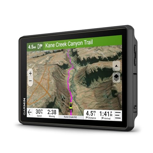
Who needs a rugged, trail-ready GPS built specifically for side-by-side adventures? I do-and the Garmin Tread 2 SxS Edition delivers. Its 8-inch ultrabright touchscreen works with gloves and survives dust, water, and extreme temps thanks to IP67 rating. I get turn-by-turn navigation using OpenStreetMap, MVUM, and preloaded Adventure Roads data. It includes HD elevation maps, land boundaries, snow trails, and 46,000+ campgrounds. I can add satellite imagery over Wi-Fi and upgrade to Outdoor Maps+ for burn zones and night lights. I connect it to my phone for live group tracking, photo sharing, and ride ratings-all through the Tread app. It comes with a tube mount and bare-wire cable. Built-in sensors include altimeter, barometer, compass, and pitch/roll gauges for serious off-road navigation.
Best For: Off-road enthusiasts and side-by-side vehicle riders who need a durable, feature-rich GPS for navigating rugged terrain and sharing adventurous rides.
Pros:
- Large 8-inch glove-friendly touchscreen with IP67 rating for reliable use in harsh weather and extreme conditions
- Comprehensive navigation with preloaded OpenStreetMap, MVUM, HD elevation maps, land boundaries, and over 46,000 campgrounds
- Advanced connectivity with smartphone app for live group tracking, photo uploads, trail ratings, and downloadable satellite imagery
Cons:
- Some advanced mapping features like burn zones and night lights require a paid Outdoor Maps+ subscription
- Group ride tracking depends on cellular signal and continuous app usage, limiting off-grid functionality
- Installation requires hardwiring, which may be less convenient for users seeking plug-and-play setup
Garmin Tread Powersport Navigator (010-02406-00)
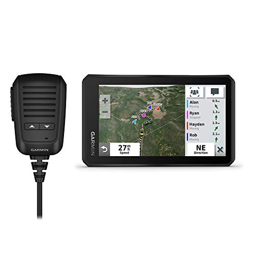
The Garmin Tread Powersport Navigator (010-02406-00) is built for serious off-road riders who demand rugged reliability and advanced navigation in extreme conditions. Its 5.5” glove-friendly, ultrabright touchscreen stays readable in direct sunlight. I rely on its IPX7 rating to survive dust, rain, and submersion. Built-in sensors-altimeter, barometer, compass, gyroscope, pitch and roll gauges-deliver precise positioning where GPS signals weaken. I use Group Ride Radio with a fist mic to talk to up to 20 riders. Preloaded topographic and street maps cover North America, including Forest Service trails and MVUMs. I overlay BirdsEye Satellite Imagery for better terrain context.
Best For: Off-road and powersport enthusiasts who need a durable, feature-rich navigation system for remote and rugged terrain.
Pros:
- Rugged, IPX7-rated design withstands harsh conditions including dust, rain, and submersion
- Integrated Group Ride Radio and preloaded topographic maps enhance off-road coordination and navigation
- Supports advanced connectivity with inReach, dog tracking, and wireless camera systems for expanded functionality
Cons:
- Advanced features require multiple separate purchases (e.g., inReach, BC 40 camera)
- Limited to North American maps by default, with international coverage requiring additional downloads
- Complex feature set may overwhelm casual riders or those new to GPS navigation
Garmin Tread 2 Powersport Navigator

When tackling rugged trails or deep backcountry routes, I rely on the Garmin Tread 2 Powersport Navigator for its 6” ultrabright touchscreen that remains fully functional even with gloves on. It’s IP67-rated, surviving dust, immersion, and extreme temperatures. The preloaded maps include OpenStreetMap, Forest Service trails, and City Navigator data. I use its turn-by-turn off-road routing daily. High-definition topographic maps show elevation, land boundaries, and campgrounds. It supports snowmobile trails in select U.S. and Canadian regions. Satellite imagery downloads over Wi-Fi-no subscription needed. With the Tread app, I share GPX files and track rides in real time.
Best For: Adventurous off-road riders and snowmobilers who need a durable, feature-rich GPS navigator for remote trails and extreme conditions.
Pros:
- Rugged, glove-friendly 6” ultrabright touchscreen with IP67 rating for reliable use in harsh environments
- Comprehensive preloaded maps including OpenStreetMap, U.S. Forest Service trails, and topographic details with turn-by-turn off-road navigation
- Supports advanced features like Wi-Fi satellite imagery downloads, real-time group tracking via app, and winter trail routing for snowmobiling
Cons:
- Real-time group tracking requires companion smartphones with active cellular and Bluetooth, adding dependency on external devices
- Premium mapping layers like slope angle and avalanche risk require a subscription (Outdoor Maps+)
- Limited snowmobile trail content available only in select U.S. and Canadian regions
Garmin Tread 2 Overland Edition Navigator

If you’re tackling rugged overland expeditions where standard GPS units fail, the Garmin Tread 2 Overland Edition Navigator stands out with its 8-inch high-resolution ultrabright touchscreen designed for visibility in direct sunlight and glove-friendly operation. It’s IP67 rated, surviving dust, water immersion, and extreme temperatures. The rugged mount uses a magnetic lock and heavy-duty suction for high vibration resistance. Preloaded maps include topographic data, land boundaries, and Motor Vehicle Use Maps across the Americas. Satellite imagery and premium layers like burn zones are available via subscription. I rely on its 46,000+ campgrounds and route syncing with the Tread app for real-time group tracking.
Best For: Overland adventurers and off-road enthusiasts who need a durable, feature-rich navigation device with detailed topographic maps and robust connectivity for remote expeditions.
Pros:
- 8-inch ultrabright, glove-friendly touchscreen with IP67 rating for superior durability in extreme conditions
- Preloaded topographic maps, land boundaries, Motor Vehicle Use Maps, and access to over 46,000 campgrounds across the U.S.
- Seamless route syncing and real-time group tracking via the Tread smartphone app with support for vehicle-specific routing
Cons:
- Premium map layers like burn zones and night lights require a separate subscription
- Reliance on smartphone app and cellular connection for full functionality, including group tracking
- Large 8-inch form factor may be cumbersome for smaller dash installations or portable use
MUNBYN 11-inch Rugged Tablet ILT02

You need rock-solid performance in remote terrain-this rugged tablet delivers. I rely on its Android 14 system and Mediatek 8781 CPU, which offers double the speed of similar chips. With 16GB RAM (8GB physical + 8GB virtual), multitasking across 1,000+ apps stays smooth. It’s built tough: IP68 and MIL-STD-810H certified, surviving 1.2-meter drops, dust, and 30-minute submersion up to 1 meter. The 11-inch sunlight-readable display works in heavy rain. A 10,000mAh battery charges to 76% in 60 minutes with 33W fast charging. 128GB storage expands to 512GB via Micro SD. It supports 4G LTE, GPS, drone links, and UTV mounting. I use the 48MP rear and 32MP front cameras for sharp field imaging. Four speakers provide clear audio. My unit’s backed by a 2-year warranty, including one free replacement for non-human damage and lifetime tech support. I remove the protective film before camera use.
Best For: Outdoor professionals and adventurers who need a durable, high-performance tablet for demanding environments and multitasking.
Pros:
- Powerful Mediatek 8781 CPU and 16GB RAM deliver smooth performance for multitasking and resource-heavy apps
- Rugged IP68 and MIL-STD-810H construction withstands drops, water, dust, and extreme conditions
- Long-lasting 10,000mAh battery with 33W fast charging and extensive connectivity options including 4G LTE, GPS, and drone integration
Cons:
- Virtual RAM may not provide the same efficiency as fully physical RAM under heavy loads
- No mention of Wi-Fi 6 or advanced security features like facial recognition or fingerprint sensor
- Protective film on camera requires manual removal, which could be easily overlooked by users
Magellan TN7881SGLUC TR7 Trail and Street GPS Navigator with A Camera

The Magellan TN7881SGLUC TR7 Trail and Street GPS Navigator with Camera stands out for off-road enthusiasts who demand seamless navigation across uncharted trails and paved roads. I rely on its turn-by-turn guidance for 4WDs, ATVs, motorcycles, and snowmobiles. It comes preloaded with over 100,000 trails and millions of Points of Interest. Its crowd-sourced trail database guarantees up-to-date routes. The touchscreen interface supports touch-based controls and advanced trail searches. I can record my tracks, publish them to the community, and access user-contributed updates. It bridges street and trail navigation flawlessly.
Best For: Off-road adventurers and outdoor enthusiasts who need reliable, detailed navigation for trails and streets across various vehicles like 4WDs, ATVs, motorcycles, and snowmobiles.
Pros:
- Preloaded with over 100,000 trails and millions of Points of Interest for comprehensive coverage
- Crowd-sourced trail database ensures up-to-date and community-verified routes
- Touchscreen interface with advanced trail search and track recording for enhanced usability
Cons:
- Camera functionality is not detailed, potentially limiting its utility for photo-based navigation
- Reliance on crowd-sourced data may lead to inconsistencies in trail accuracy
- Larger size or rugged design may reduce portability compared to standard GPS units
Garmin Overlander, Rugged Multipurpose Navigator for Off-Grid Guidance
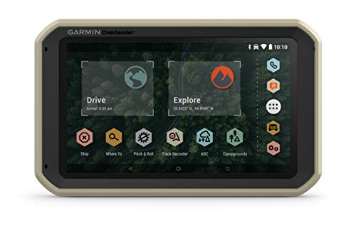
A go-to navigator for overlanders tackling remote terrain without reliable cell service, the Garmin Overlander delivers military-grade reliability in a compact, vehicle-mounted package. I rely on its 7” color touchscreen for clear visibility in direct sunlight. It supports GPS, GLONASS, and Galileo satellites, ensuring accurate tracking in canyons and dense forests. Preloaded topographic maps cover North and South America, including 4×4 roads and public land boundaries. I use routing calibrated for my vehicle’s height, weight, and length. It stores 64 GB of data and syncs via Wi-Fi using the Garmin Explore app. I access USGS Quad sheets and offline POIs like ioverlander spots and public campgrounds. When paired with an inReach device, I send texts and get SOS capability and weather updates. I also connect up to four BC 35 backup cameras for enhanced visibility. The powered magnetic mount sticks securely and works with RAM systems for flexible dashboard or windshield placement.
Best For: Overlanders and off-road adventurers who need a rugged, reliable navigator with offline mapping, vehicle-specific routing, and satellite communication capabilities in remote areas without cell service.
Pros:
- Preloaded topographic maps and extensive POIs including public lands, 4×4 roads, and camping spots for true off-grid navigation
- Supports GPS, GLONASS, and Galileo satellite systems for superior tracking accuracy in challenging terrain like canyons and forests
- Integrates with inReach satellite communicators for two-way texting, SOS, and weather forecasts, enhancing safety in remote locations
Cons:
- Satellite communicator and backup cameras sold separately, increasing overall cost
- 64 GB storage, while generous, may still be limiting for users downloading numerous high-resolution maps or updates
- Wi-Fi required for syncing maps and data via Garmin Explore app, which can be a hurdle in off-grid environments
Garmin Tread Overland Navigator with Ultrabright Display

Built for overlanders who demand reliability in extreme terrain, the Garmin Tread Overland Navigator with Ultrabright Display delivers high-visibility navigation and rugged performance when off-grid. Its 8” ultrabright touchscreen has a 1280 x 800 resolution, making maps easy to read in direct sunlight. The device is IP67-rated, surviving dust and submersion up to 1 meter for 30 minutes. It runs on Android OS and includes a lithium-ion battery, suction cup mount, and vehicle power cable. Preloaded maps feature OpenStreetMap trails, USFS roads, and topographic data for North and South America. BirdsEye Satellite Imagery downloads directly-no subscription needed.
Best For: Overlanders and off-road adventurers who need a durable, high-visibility GPS device with advanced navigation and satellite communication for use in remote, challenging environments.
Pros:
- Rugged IP67-rated design with ultrabright 8” display ideal for harsh conditions and direct sunlight visibility
- Preloaded topographic maps, adventure trails, and subscription-free BirdsEye Satellite Imagery enhance off-grid navigation
- Integrated inReach technology enables global two-way satellite messaging, SOS, and real-time location sharing
Cons:
- Requires active subscription for full inReach and SOS features, adding ongoing cost
- Large size and 1.42-pound weight may be cumbersome for compact vehicle setups or portable use
- Some advanced features like Group Ride Mobile depend on cellular connectivity and paired smartphone, limiting offline functionality
Factors to Consider When Choosing an Off Road GPS
You need an off-road GPS that keeps up with tough conditions and gives you reliable navigation when it matters most. Look for a display that’s both durable and easy to read in direct sunlight-many top models use transflective TFT screens up to 6 inches with brightness levels exceeding 1000 nits. Battery life matters too, especially on long trips; some units offer 16+ hours on a single charge and support solar charging or vehicle power integration for extended use.
Display Durability And Clarity
Your off-road GPS’s display must withstand harsh environments without compromising readability or function. Look for an IP67 or IP68 rating-this means the screen resists dust and survives submersion up to 1 meter for 30 minutes. A ruggedized design certified to survive drops from 1.2 meters guarantees durability on rough trails. For clarity, choose displays with ultrabright technology and high resolution. These screens remain visible in direct sunlight, just like premium smartphones in daylight. Anti-reflective or matte coatings cut glare, enhancing readability in shifting light. Touch responsiveness matters too: glove-friendly touchscreens let you operate the device with thick winter gloves. Don’t settle for basic LCDs-opt for tempered, scratch-resistant glass with layered protection. These features work together to keep your GPS functional and legible in dust storms, rain, or bright alpine sun. Clarity and toughness aren’t luxuries-they’re essentials.
Battery Life And Charging
Often, battery life determines whether your off-road GPS keeps pace with multi-day adventures. Devices with 8,000mAh or higher capacity typically last up to 11 hours continuously-ideal when power sources are unavailable. You’ll want that endurance on remote trails. Fast charging helps when you can plug in. A 33W charger reaches 76% in 60 minutes, cutting downtime nearly in half compared to slower 20W options. Screen size and brightness directly impact power use. Larger ultrabright displays consume more, especially in sunlight-readable mode. To conserve battery, you can lower the brightness or use power-saving modes. Some units run indefinitely by connecting to your vehicle’s power, bypassing internal battery limits on long trips. Extreme cold or heat degrades performance. Choose a model rated for wide operating temperatures to maintain charge stability in harsh conditions.
Mapping Features And Accuracy
When traversing remote off-road terrain, precise mapping features and accuracy make the difference between smooth progress and getting stranded. You need preloaded topographic maps with high-definition digital elevation models for clear terrain visualization and accurate route planning. Turn-by-turn navigation powered by OpenStreetMap and Motor Vehicle Use Maps guides you reliably on unpaved roads and backcountry trails. Subscription-free downloadable satellite imagery adds real-world context, improving map precision for identifying campsites, trails, and obstacles. Overlaid public and private land boundaries keep you compliant with access rules and prevent accidental trespassing. Custom routing based on your vehicle’s height, weight, and clearance filters out impassable roads, enhancing navigation safety. These features work together to deliver dependable, detailed guidance exactly where standard GPS systems fail-deep in off-grid environments with no cell service.
Connectivity And Device Integration
While exploring remote terrains, staying connected isn’t just convenient-it’s critical for safety and coordination. You need GPS devices with satellite communication for two-way messaging and SOS alerts-models like Garmin inReach require subscriptions and comply with FCC regulations. Pair your unit with a smartphone via Bluetooth or Wi-Fi to sync waypoints, tracks, and routes seamlessly. Some GPS navigators support real-time group ride tracking by linking to cellular-enabled phones, letting you monitor teammates’ locations. You can also integrate external accessories: wireless backup cameras and digital switch boxes connect directly, enabling control of vehicle systems from the dashboard. Advanced models let you pair pet or asset trackers using low-energy wireless protocols like ANT+ or Bluetooth LE, so you can monitor off-grid gear or companions. These integrations guarantee your GPS does more than navigate-it connects your entire off-road ecosystem.
Environmental Resistance Ratings
A durable off-road GPS must withstand harsh elements, and environmental resistance ratings give you clear metrics for performance under stress. Look for an IP68 rating-it guarantees total dust protection and submersion in up to 1 meter of water for 30 minutes. That means your device survives river crossings and dusty desert trails. An IP67 rating also blocks dust and handles the same water exposure, but with slightly less long-term submersion security. If your unit has only IPX7, it resists water at that depth but offers no dust guarantee-riskier in sandy environments. MIL-STD-810H certification adds critical durability, proving resistance to drops from 1.2 meters, extreme temperatures, shock, and vibration. Together, these ratings guarantee reliable function in mud, rain, high humidity, and rough terrain. Don’t skip this spec-your GPS will face nature’s worst. Choose devices with verified protection to stay on course without fail.
Mounting Options And Portability
Your GPS must survive extreme conditions, but it also needs to stay securely in place when the terrain gets rough. Devices with IP67 or IP68 ratings resist dust and immersion in 1 meter of water for up to 30 minutes, making them ideal for permanent outdoor mounting. Use rugged magnetic or suction mounts with locking mechanisms to prevent vibration-induced loosening on vehicles. Tube mounts and roll bar clamps fit standard 1.25” to 1.5” diameters, ensuring stability on ATVs, motorcycles, and UTVs. These designs allow glove-friendly access and quick repositioning. For continuous power, connect via built-in vehicle cables or hardwire directly to your electrical system. Choose lightweight units under 1.5 pounds with compact builds-they’re easy to move between machines or carry as handhelds. Portability and secure mounting go hand in hand for reliable navigation on every off-road journey.
Frequently Asked Questions
Are These GPS Devices Waterproof or Just Water-Resistant?
Most off road GPS devices are water-resistant, not fully waterproof. You’ll find many rated IPX7, meaning they survive immersion in 1 meter of water for 30 minutes. They handle rain, mud, and splashes effectively. True waterproof models are rare and typically overkill. Always check the IP (Ingress Protection) rating. Devices with IPX7 or higher withstand harsh outdoor conditions without internal damage, ensuring reliable navigation even in wet environments.
Can I Use These GPS Units on Motorcycles?
Yes, you can use these GPS units on motorcycles. They’re built for rugged, mobile use with high-visibility screens readable in direct sunlight. Most feature glove-friendly touch interfaces or physical buttons for ease of use. Mounts are available for handlebar attachment, often vibration-resistant. Units like the Garmin GPSMAP 66i or 67i support 3-axis compasses and barometric altimeters. They lock onto satellite signals quickly, even at speed.
Do Any Models Support Offline Topographic Maps?
Yes, several models support offline topographic maps. You can download detailed 24K USGS and global TOPO maps directly to devices like the Garmin Overlander and Montana series. These units store maps on internal memory or microSD cards, so you don’t need cell service. The maps include 10-meter contour intervals, elevation data, and trail networks. You can navigate rugged terrain confidently, even in remote areas with zero connectivity.
How Often Do the Maps Get Updated for Free?
You get free map updates once a year for most off-road GPS devices. Manufacturers like Garmin and Magellan offer this through software like BaseCamp or online accounts. Updates include new trails, roads, and terrain data. You must manually download and install them. Some devices support automatic notifications. The update cycle guarantees accuracy without extra cost. Outdated maps lack recent trail changes. Think of it like a yearly tune-up-essential, predictable, and critical for reliable navigation in remote areas.
Can I Connect These GPS Devices to My Phone?
Yes, you can connect most off-road GPS devices to your phone via Bluetooth or Wi-Fi. Manufacturers like Garmin and Magellan support smartphone pairing for notifications and live tracking. You’ll need the companion app-like Garmin’s Drive or BaseCamp-installed. Pairing lets you access weather, traffic, and emergency alerts in real time. USB cables enable data transfer and firmware updates. Check device specs; not all models support Apple CarPlay or Android Auto. Connectivity boosts functionality without compromising rugged performance.